
Preparing to launch...


Powered by DroneDeployWhat is the most efficient way to stay on top of overall progress on my large-scale construction project - even when I can't get all of my stakeholders there?

From pre-construction, to comparisons for deviations of site actuality to designs plans from leading CAD software, to site management to post-completion inspections, ACOMS can help keep your team on schedule, on budget, and safer.

Pre-Construction Solutions

Leveraging the enterprise-class Matrice 300 RTK, 360 degree walk through cameras, and the power of DroneDeploy, we can assist in your pursuit and bidding activities.
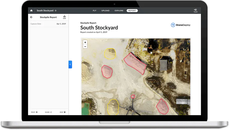
  • Capture job-site data in real-time using live mapping technologies that work even when Internet connectivity is not available.
  • Create 360 degree virtual walk-through tours to assist in planning and coordination activities.
  • Stay ahead of your competition with expedited site-planning and design including backing maps and models.
https://acoms.us/wp-content/uploads/2023/03/inventory.webp
https://acoms.us/wp-content/uploads/2023/03/ma1.webp

Expedited Construction Projects

Save time and money, while providing supporting documentation.

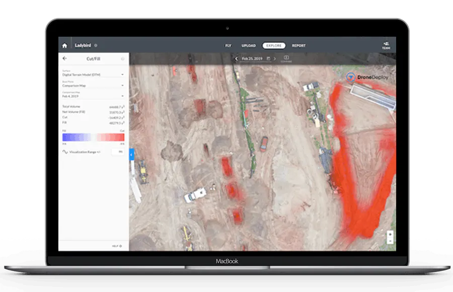
  • Easily detect deviations from plan by comparing flight captured to pre-construction designs generated in Procore, Autodesk, Plangrid, etc. (DXF or DWG overlay or import of GeoTIFF datasets to your software)
  • Generate progress reports on demand and communicate to stakeholders at any stage of the project.
  • Verify work and billing from 3rd parties using automated cut-fill analysis coupled with side by side comparisons between flights.
  • Track week over week progress and grant access to those who need to know, from any Internet-connected device in the free world.

“Anywhere” access

Leverage cloud-based technology to improve communication.
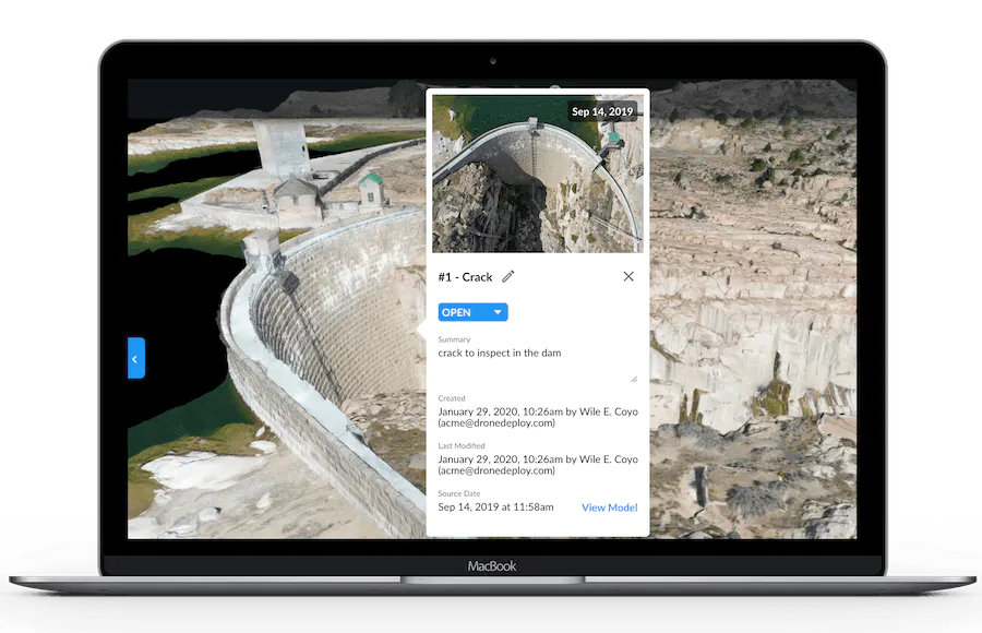
  • Provide a visual record of site conditions for those who cannot make it on-site or it is not cost effective to bring on-site.
  • Review aerial and 360 degree ground data for a multifaceted view.
  • Increase client trust with access to accurate digital reconstructions of the site and progress.
  • Automatically share dataset artifacts in your project management software when using Procore or Autodesk BIM 360.
https://acoms.us/wp-content/uploads/2023/03/safety.webp
engineer and trades

Engineer & Trades

Increase the speed and efficiency of earthmoving projects with automated cut/fill analysis, stockpile tracking, and reporting.
https://acoms.us/wp-content/uploads/2023/03/pm.jpg

Project Managers

Keep projects on schedule, report progress, and manage logistics with regularly-generated datasets of site reality.
Board directors having a meeting with the team in the office at the construction site

Owners & Executives

Aerial and ground-collected datasets allow you to stay advised of your project, without ever stepping on-site.
https://acoms.us/wp-content/uploads/2023/04/color_logo.png

A regional leader in orthomosaic and mapping services.

1-352-777-4077